™
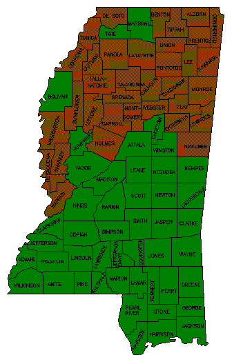
Mississippi Land Ownership Maps
Company
About Us
Contact Us
Site Map
Land Ownership Maps
Map Price List
Online Sample Maps
Other Services
Tax Mapping
911 Mapping
Map Legend
Rivers & Creeks
River and Creek
Information
Useful Links
Forestry
(Privacy Policy)
(Terms of use)
tabmap.com is produced by TAB MAP Company, Inc.
Content copyright © All rights reserved.